
People in the Middle Ages greatly lacked geographical knowledge. While they were aware of the existence of distant places like China and sub-Saharan Africa, their knowledge was largely based on the scanty information found in ancient texts, which were notoriously inaccurate. What is more, medieval scholars saw a theological significance in the natural world in which everything was designed according to a harmonious model set in place by God. Thus geographical accuracy did not matter as much as symbolic importance. This is most evident in the so-called T and O maps that conceived of the world as divided into Asia, Africa, and Europe. The number three corresponded with the Trinity and was also backed by the Biblical story of Noah's three sons who scattered and repopulated the world after the Flood.
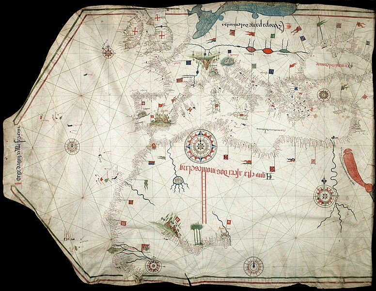
In the later Middle Ages, as new navigational technology came to Europe from the Arab world and seagoing trade was recognized as an important source of revenue for centralizing states, there was a greater emphasis on geographical accuracy. This site has a zoomable image of a "Portolian Chart", which is an ancestor of modern navigational maps. You will see much greater accuracy of the shape of the coastlines along with the names of the towns and cities that dotted them. This map is also remarkable for the detail of the western coast of Africa, although it still exposes some important gaps in the medieval knowledge of the world (notice the Nile River).
This new form of mapmaking does not mean that people of the Middle Ages were entirely ignorant of the layout of the world around them. They knew that the neat division of the world into three parts was an oversimplification. What this reveals is a shift in attitudes towards the world around, where it was no longer just a form of theological instruction.

